The north shore of Loch Mullardoch is not a Challenge trade route. From Strathcarron, the obvious route west is via Loch Monar and from Shiel Bridge, Glen Affric is the logical route. Mullardoch may be a route from Dornie but it seems that most Dornie starters head for Glen Affric - either via the Falls of Glomach or via Gleann a Choilich at the west end of Loch Mullardoch.
I’d seen Loch Mullardoch from the hills but I’d never been on its shores so I thought it would be an interesting route to try. I also wanted to see the Falls of Glomach so I decided on a Shiel Bridge start with a camp at Iron Lodge in Glen Elchaig on the first night.
I did the usual search for information on Loch Mullardoch on the web and on the Challenge message board. The most common sentiment seemed to be ‘never again’, with tales of scary river crossing and trackless flogs through West Highland bogs. But there was very little hard information about the walk. So, for future Challengers, I thought I should write something about my day along Loch Mullardoch.
I camped at Iron Lodge and, after a night of rain, woke to a beautiful morning. The path from there is obvious - a series of zig zags up the hill on a track made for quad bikes or argocats. It’s churned up in places, stony in others and, in truth, not particularly pleasant walking. However, it improves when you get to the top of the hill with fine views at the Loch an Droma. Soon after, you get your first view of Loch Mullardoch.
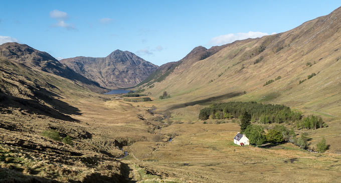
Iron Lodge is in a poor state now, barely habitable although some Challengers cooked in the building rather than in their tents. The zigzag path up the hill from the Lodge is brutal but the view makes it worthwhile.
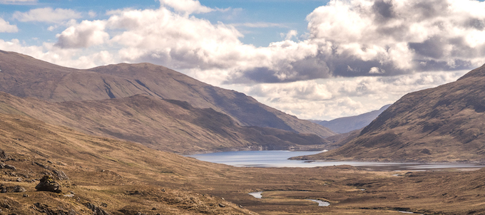
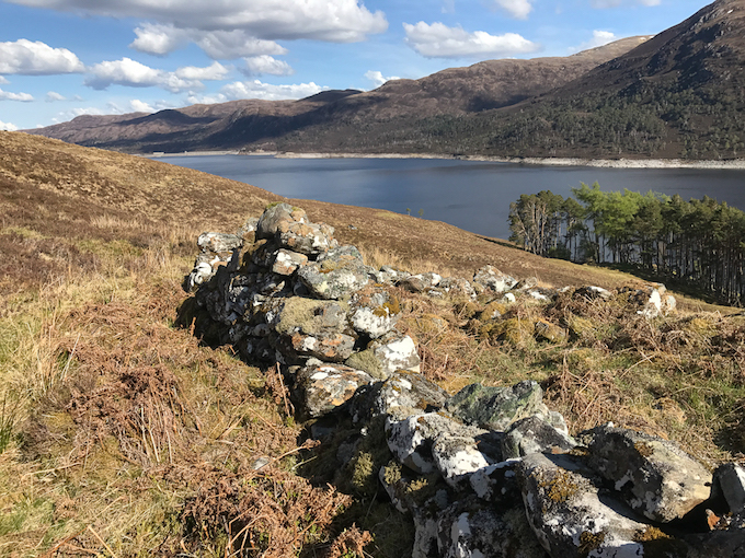
The track deteriorates as it gets down to the level of the loch and eventually disappears. You need to pick your way through the bogs to reach the head of the loch. I found this stage to be the worst stage of the walk. There are bits of path which tempt you in one direction then they disappear and you see another vague path somewhere else. There’s a path marked on the 1:50000 map from Am Man but I never found it. At the dog leg in the loch, I kept high before descending to the building at Glen Cannich. There are bridges over both the Allt Coire a Mhaim and the Allt Socrach - neither shown on the 1:50000 map.
The next stage is on a reasonable path from Glen Cannich to the Allt Taige. Basically, this is about 5km along the side of a steep slope that goes straight into the loch. The path is obviously an old stalkers path and it was much better than I expected with only a few short sections where it disappeared. Once you are on this stage, you are committed. There’s absolutely nowhere to camp or shelter.
It was on this section that I came across a herd of wild goats with kids on one side of the path and adults on the other. I was very wary of continuing as these are quite large creatures and I really didn’t fancy a charge from a frightened nanny goat. So, I made lots of noise and, showing no signs of panic, they eventually wandered away.
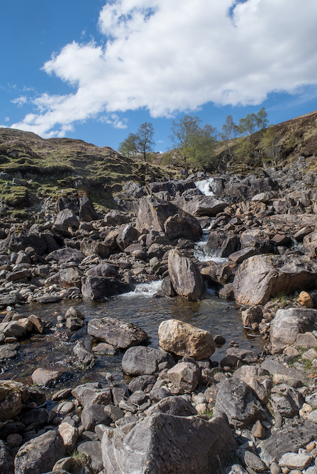
The Allt Taige has a fearsome reputation but, instead of a tiger, it was a pussycat when I was there. It’s obvious, however, that this would be a real obstacle if it was in spate. There is a bridge about 200m higher up but I easily crossed the river on stepping stones just below the waterfall. By this time, I was feeling quite tired so I was delighted that I didn’t have a pathless trudge up the steep slope by the side of the river to the bridge.
After crossing the river, you have another pathless section until you intersect with the path that descends from the bridge. On this section, as on other places on the lochside, you come across ruins of summer shielings where crofters used to take their animals in summer for feeding.
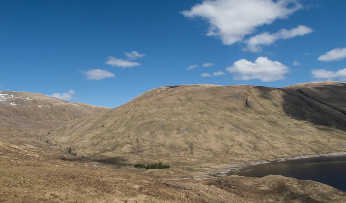
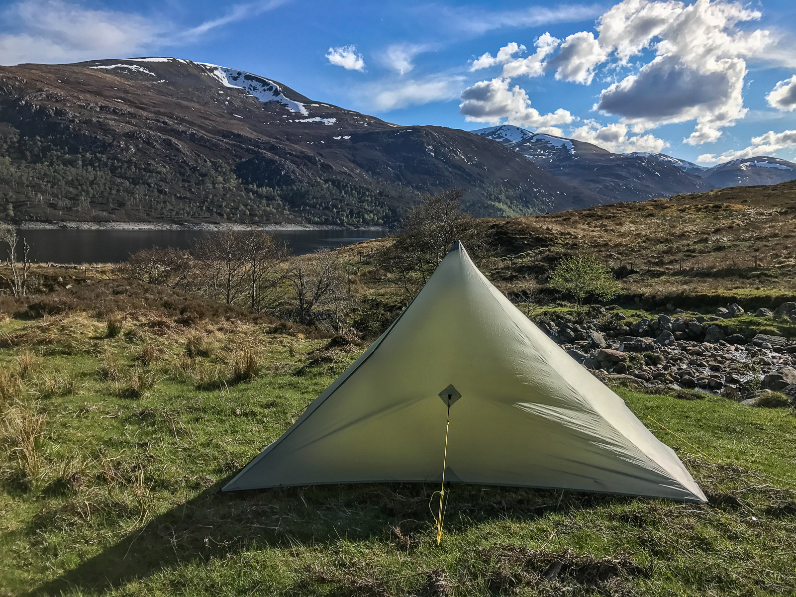
It’s a bit of a bog flog to get to a good track that takes you to Allt Mullardoch. Again, there’s a bridge across the river that isn’t marked on the map. There’s a fabulous site to pitch just across the bridge. I had intended to go on but this was so nice I had to stop for the night. I sat in the sun and enjoyed my cous-cous.
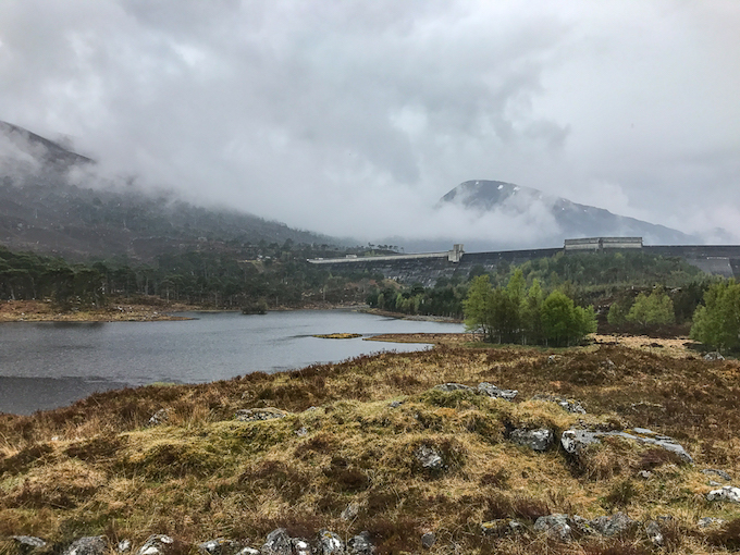
After this, it’s road walking on a hydro road to where it meets the public road at the dam. I had my final couple of hours of light rain that morning - after that, every day was dry.
Long ago memories for me as my father was a quality engineer for the government programme to ‘electrify the Highlands’ in the 1950s and 1960s. He was often away from home in the Highlands when I was a child and talked fondly of his experiences in the, then rarely visited, Highlands.
The walk along Loch Mullardoch is a great walk with varied terrain and scenery. I had a beautiful day so had it pretty easy but it was still a tough and tiring walk. In bad weather the walk might not have been so much fun but it was the highlight of my Challenge.